Monday, April 25, 2011

Busted Pisgah Loop

Yesterday, I went for a ride in Pisgah and wanted to do some exploring/scouting for PMBAR. I knew that one of the checkpoints in the past had been the intersection of Squirrel Gap and Cantrell Creek, so I thought I'd go there. I parked in my usual spot in front of the South White Pines Group Camp, and headed up 477 and Clawhammer. Once I reached Buckhorn Gap, I headed down the trail with the same name to S. Mills River trail and turned right. This is an easy trail, so of course I wrecked on it on a big, slippery rock. Not too much damage was done, so on I went.

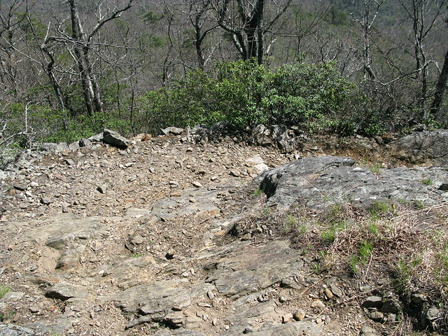
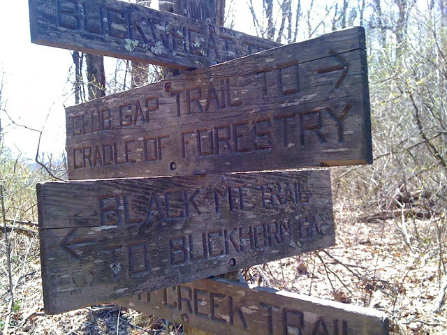
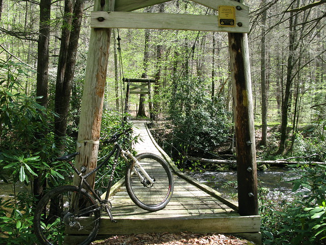
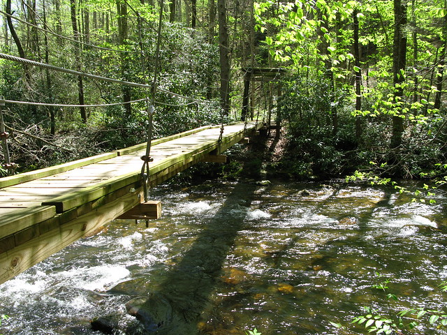
I made it down the switchbacks to the suspension bridge just before the intersection with Squirrel Gap.
IMG_1157

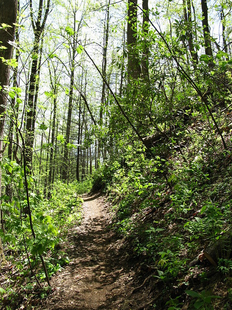
The first part of Squirrel is tight, twisty, and low, and actually reminded me a bit of trails in Ohio. Once you hit the intersection with Horse Cove (I think), the trail turns into pristine, benchcut singletrack that flows nicely along the contour of the mountain.
IMG_1159

I made it to the intersection with Cantrell Creek Trail, but not before having to cross Cantrell Creek itself.
IMG_1158

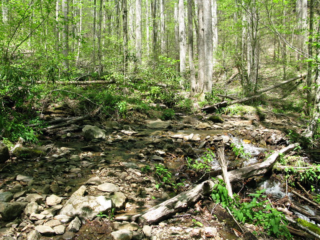
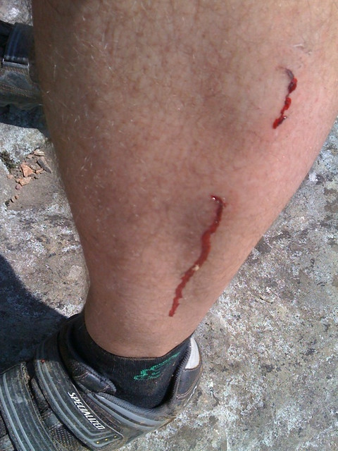
At this point, I had a loop in mind, and headed down Cantrell Creek Trail. I liked the tight, techy feel of this trail with all of the rocks and creek crossings, but I didn't like how overgrown it was. My legs were quickly sliced up. Also, this trail has 10-15 creek crossings on it, and the water was flowing, so I was only able to really ride across a few of them. It was hot out, though, and I didn't mind the wet feet.

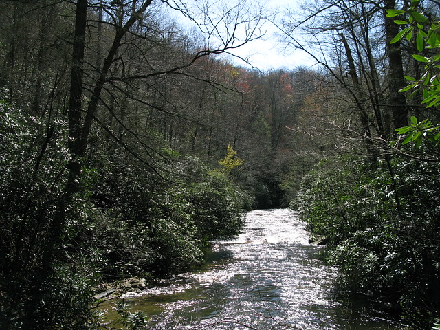
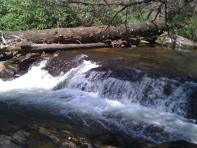
I made it down to the intersection with S. Mills River Trail, and this is where we get to the busted loop. I inconveniently forgot that this section of the trail requires you to cross the S. Mills River many times without the help of a nice suspension bridge. I mentioned before that Cantrell Creek was flowing, but it was nothing compared to the river. I started the first crossing, and almost lost my footing a couple of times, with the water coming up to my lower thigh. I made it, though, and continued on to the second crossing. This one looked a little deeper, so I looked for a better place to cross. The place I found was still deep and flowing hard, but the deep section looked to be shorter, so in I went. The water here came up to mid to upper thigh, and the rocks were slippery as snot. Somehow I made it and continued on. I got to the third crossing and said "no mas." It was a very wide crossing, and looked to be even deeper. It was just a little too much to attempt alone, so I turned around.

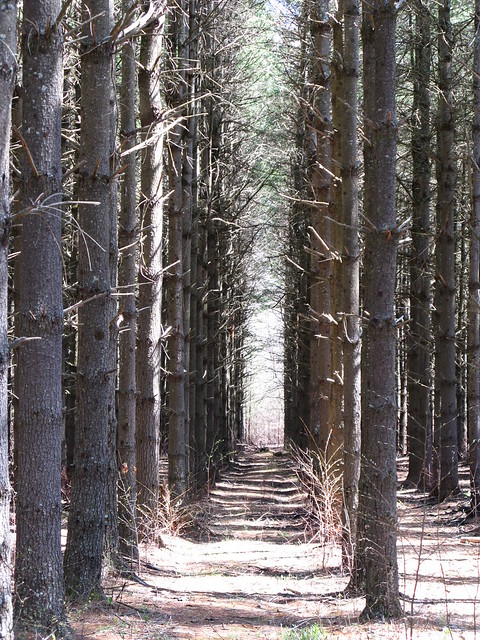
I barely made it back across the first two crossings, and continued on S. Mills Trail the other direction, past the intersection with Cantrell. The trail basically turned into an old road bed, and the trip up to Turkey Pen Rd. was uneventful. I was happy to see three more of these along the way.
IMG_1160

Not really feeling like I had the energy to head up Turkey Pen Gap Trail to Black, I shot down the road and pedaled the pavement back to my car, which of course was pretty lame. I still managed to get 30 miles in, though, and had a good adventure.

Tuesday, April 19, 2011

Laurel, Revisited

When I first moved down here, the Laurel/Pilot route was one of my first rides in Pisgah. At that time I was riding my rigid, SS Karate Monkey and between finishing law school, studying for and taking the bar, and then moving to Brevard, my fitness level was dreadful. Now, I would say my fitness level has risen to the level of "poor," so I thought it was time to hit this route again on the Lazer Cat. Only, by the time I decided to ride up Laurel, I had already put in 15 miles in Pisgah, which is roughly equivalent to 127 miles on any trail system in Cincinnati.

The ride up Laurel started off much better than last time, and I think a lot of the reason was the addition of gears. Laurel has some pretty technical sections, and I still couldn't clear most of them, but did better. On my way up, there was a group of three riders that passed me in the other direction, easily clearing a section that I wouldn't even attempt. Not too long later, they passed me in the other direction. There really are some amazing riders around here.

Anyway, I eventually made it to Pilot, and wussed my way down switchback hell and through the rock garden. I ended up doing 36 miles, and felt pretty rough by the end. My fitness is really improving, but I need to work on feeding myself better on long rides. A Cliff bar just isn't going to cut it. For anyone interested, my route for the day was 477>Clawhammer>Buckhorn Gap>S. Mills River>476(?)>1206>Laurel>Pilot>1206>276>477.

A few pics:

IMG_1149

IMG_1151

IMG_1153

IMG_1154

IMG_1155

IMG_1156

Monday, April 11, 2011

Family Visit and Riding

Heather's parents came up to see our new house this weekend, so Friday and Saturday we hung out with them. Before we met up with them on Saturday morning, though, we walked down the street and watched the roadies from the Assault on the Carolinas zip by.

IMG_1131

I believe there were 700-800 riders this year, and it was more of a festival atmosphere than in years past. They had a band playing, vendor booths, and food and drink booths. Hopefully a precursor to a mountain bike festival in the near future? If you rode in the race, I might have a pic of you if you go to my Flickr page.

Sunday, we met the pseudo in-laws for breakfast before they headed home, and then I went to Pisgah for a longer ride. I started off climbing up Clawhammer, and immediately regretted eating french toast right before the ride. I felt better by the time I hit the top though, and continued down Buckhorn Gap to South Mills River. That was my first time down that way, and I really enjoyed it.


From S. Mills, I took Pink Beds. I really wanted to do Squirrel, but I had no way to get more water, having left my filter at home. Once I got up to the Pink Beds lot, I refilled my water and headed down 276 to 477, and up Club Gap. Club Gap is rough and straight up, but thankfully short. I then sat down in whatever shade I could find for a quick break at the intersection.


I was thinking about going down Avery, but felt like I had a little more in the tank, so I headed up Black instead. On a downhill section, I came around a corner a little too hot, and my front wheel slid out. Everything went in slow motion for a second, and down I went. I landed hard on my left side and just stayed still for a minute. Once I realized that nothing was broken (bike or body), I got up and noticed the major knot in the side of my calf. I tried to work it out, but it wasn't helping, so on I went.


Once I got down to Buckhorn Gap, I was really wishing I had just gone down Avery, and in fact, I still wanted to go down Avery, but how should I get over there? Well I decided I wasn't beat up enough, so I thought some exploring would be in order. I had noticed an unimproved road on the map that connected Clawhammer to Avery (5057), and wanted to check it out. I headed down the somewhat overgrown path, and all was well for a bit, but then I ran into sections that were totally overgrown with thorn bushes. I was glad I had just filled my tires with some fresh Stan's, but wished I had worn long pants and long sleeves.

I eventually made it over to Avery, and the trip down was a blast, and uneventful. It was a great, and long day in Pisgah. This place is like nothing else. I only rode 25-30 miles, but I was in the forest for 5+ hours. The miles here are tough and slow-going.

Thursday, April 7, 2011

New Digs

I've been MIA for a bit, but it's been for a good reason. Heather and I bought and moved into our new house. It's been a crazy couple of weeks, and we are both totally exhausted, but we absolutely love our new place. We're still in Brevard, but tucked away in a quiet little corner, just outside of the city limits. Without going into too much detail, it has way more space than we need, is in great shape, and we got it for a killer price.

Now, onto the features of interest to mountain bikers. For the first time ever, I have a dedicated bike space. We have a full basement, and one section in particular just seemed perfect for it. I can keep all of our bikes, parts, tools, and accessories in one place, and still have plenty of room to work on the bikes.

Here's the space with the Lazer Cat in the stand, getting some TLC.
IMG_1119

It's not all put together yet, but I'm very excited to have it.

The next feature of interest is the setting. We are tucked away on a hill, with trees all around us. There's another house on one side, but the other side is an empty, wooded lot. Behind us is a gravel road, and then just mountains beyond that. It's so incredibly quiet and peaceful, especially compared to the townhome, which was on a very busy road, and had very thin walls separating us from our fat neighbors. The difference is remarkable, and our stress levels have just plummeted.

Back and Side Yards:
IMG_1122

IMG_1120

Now, the real kicker. If you look closely in that last pic, you can see the gravel road. About a hundred yards beyond the section you can see, the road dead ends right into a conservation easement that the city owns. If you go up there and look around, you'll see colored tape around trees. That's because the city is planning on building trails through the property, and have already started the layout phase, with construction probably starting this summer. So yes, we will have trails to ride and hike right out of our back yard.

But wait, it gets better. On the other side of that conservation easement is Pisgah. The ultimate plan is to work with the Forest Service and connect the city trails into the Pisgah trails. My guess would be that it would connect to 475C, which would mean I could ride from my house, into the fish hatchery area.

Needless to say, we are so happy and excited to be here for many reasons.